
OS Landranger Map 89 West Cumbria Cockermouth & Wast Water
Landranger maps by Ordnance Survey are an ideal all-purpose map for planning your perfect day out on foot or by car. With all the information you need to really get to know the area and the world famous OS Mapping the Landranger series are ideal for visitors tourists and local residents.
The Landranger map of West Cumbria, including Cockermouth & Wast Water. Landranger maps are perfect for extensive hikes, cycling, and driving holidays.
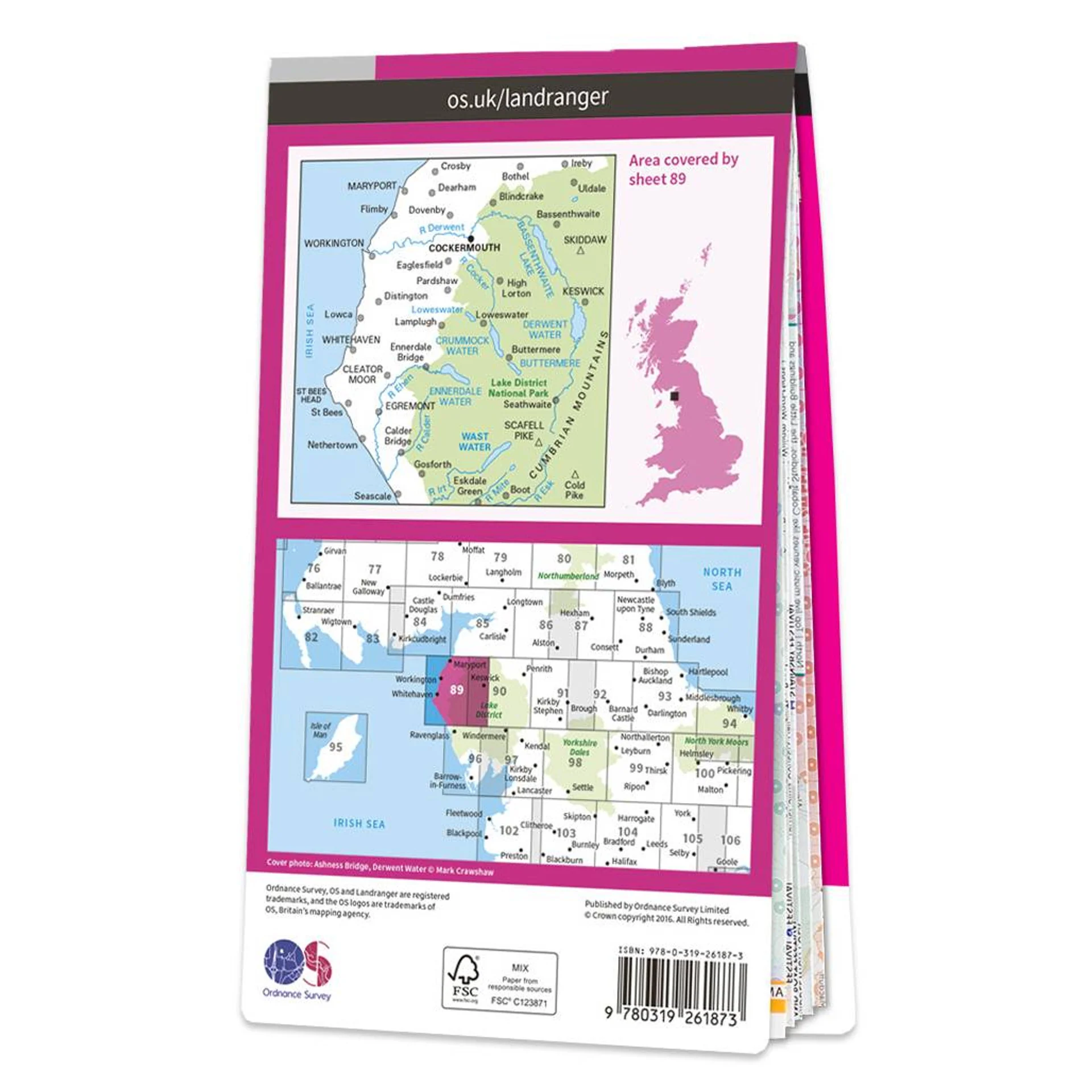
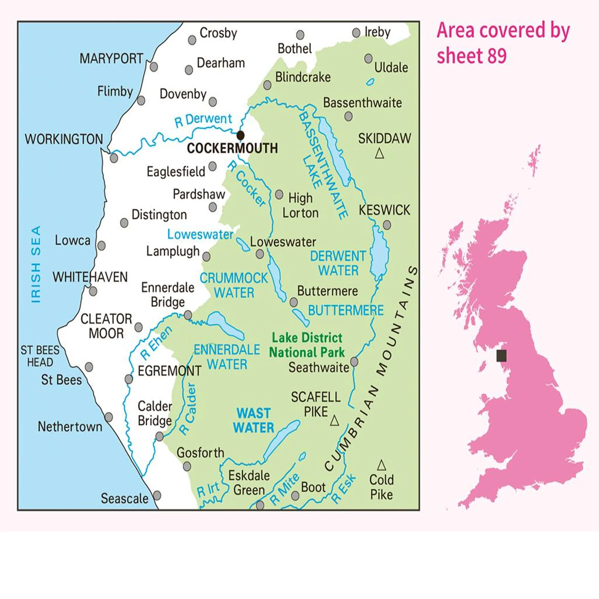
Ideal for planning days out or holidays to West Cumbria, famous for its attractive scenery and the Lake District National Park's Wast Water Lake which extends for 3 miles along the Wasdale Valley. Other highlights on this map are: Cockermouth, Workington, Maryport, Dovenby, Uldale, Ennerdale Bridge, Egermont, Gosforth, Keswick, Scaffell Pike, Cold Pike, and Skiddaw.
Our Landranger maps come in standard or Weatherproof Active, you'll also receive a free download for your devices — making for a convenient companion.
This sheet is OS Landranger 89 - West Cumbria Cockermouth & Wast Water
- 1: 50'000 Scale - 2cm to 1km - 1/1/4 inches to 1 mile
- Standard folding edition
Product Information
Product Information
Shipping & Returns
Shipping & Returns
Description
Landranger maps by Ordnance Survey are an ideal all-purpose map for planning your perfect day out on foot or by car. With all the information you need to really get to know the area and the world famous OS Mapping the Landranger series are ideal for visitors tourists and local residents.
The Landranger map of West Cumbria, including Cockermouth & Wast Water. Landranger maps are perfect for extensive hikes, cycling, and driving holidays.
Ideal for planning days out or holidays to West Cumbria, famous for its attractive scenery and the Lake District National Park's Wast Water Lake which extends for 3 miles along the Wasdale Valley. Other highlights on this map are: Cockermouth, Workington, Maryport, Dovenby, Uldale, Ennerdale Bridge, Egermont, Gosforth, Keswick, Scaffell Pike, Cold Pike, and Skiddaw.
Our Landranger maps come in standard or Weatherproof Active, you'll also receive a free download for your devices — making for a convenient companion.
This sheet is OS Landranger 89 - West Cumbria Cockermouth & Wast Water
- 1: 50'000 Scale - 2cm to 1km - 1/1/4 inches to 1 mile
- Standard folding edition